Global Positioning System (GPS) is a satellite-based navigation system that provides location and time information in all weather conditions, anywhere on or near the Earth. Developed by the U.S. Department of Defense, it became fully operational in 1995 and is now freely accessible to anyone with a GPS receiver.
GPS consists of a network of 24 satellites in orbit around the Earth, and ground control stations that monitor their signals. A GPS receiver on the ground uses these signals to calculate its location and time. The receiver determines its position by measuring the distances to several satellites and using triangulation to pinpoint its location. The accuracy of GPS can range from several metres to less than a metre, depending on the type of receiver and the number of satellites in view.
Uses of GPS
GPS is widely used in navigation systems for cars, boats, and aircraft, as well as in outdoor recreational activities such as hiking and geocaching. In addition, GPS is used in surveying, mapping, and scientific research, and has numerous applications in military, transportation, and telecommunications industries.
In recent years, the development of new technologies, such as augmented reality and the Internet of Things, has led to an increased use of GPS in a variety of applications. As GPS technology continues to evolve, here are some ways GPS is likely to play a greater role in shaping our lives and changing the way we interact with the world.
- Smartphones: GPS is used to provide location-based services such as mapping, turn-by-turn navigation, and location-based search.
- Fitness trackers: GPS is used to track and record the route, distance, and speed of outdoor activities like running, cycling, and hiking.
- Drone: GPS is used to control the position and movement of unmanned aerial vehicles (UAVs) for aerial photography, mapping, and surveying.
- Automobiles: GPS is integrated into many cars to provide navigation, traffic updates, and location-based services like search for nearby gas stations or restaurants.
- Tablets: GPS can be used for navigation and location-based services on tablet devices.
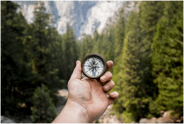
- Handheld GPS Devices: Standalone GPS devices can be used for outdoor activities, such as hiking and geocaching, or for navigation in areas without cellular coverage. Watches are a good example of this, like the Seiko Astron GPS Solar.
- Smart Watches: Some smartwatches include GPS to provide fitness tracking and location-based services.
Despite its widespread use, GPS has some limitations. It is subject to interference from buildings, mountains, and other obstacles that can block the line of sight to the satellites, reducing the accuracy of the signals. In addition, GPS signals can be disrupted or jammed by electronic devices, such as cell phones, or by intentional interference from military or other sources.
Wrapping Up
GPS is a vital technology that has revolutionised the way we navigate and understand our world. Whether used for navigation, research, or recreation, GPS has become an indispensable tool for people around the world. Long gone uses of maps to navigate us around. Applications like Waze and Google maps have revolutionised our travels, all thanks to GPS.

Author’s Bio:
Luther Abrams is quite a jack of all trades type of guy. He loves exploring new things and cultivating his knowledge every now and then. Today, he grows more and more interested in jewelry and watches and even writes about such things in his free time.